JamaicaUAV Ltd logoJamaicaUAV LtdAERIAL SURVEYING & MAPPING

AERIAL INSIGHT. SMARTER LAND DECISIONS.

One partner.
Every stage.

From finding the right land to seeing your vision through. Aerial LiDAR, mapping, and ongoing insight for every stage of your land development, across Jamaica and the Caribbean.

BASED IN JAMAICA   /   SERVING THE CARIBBEANEXPLORE THE LAND LIFECYCLE ↓FROM ACQUISITION TO LONG-TERM MANAGEMENT.
ACQUIRE→SURVEY→PLAN→BUILD→COMPLETE→MANAGE

01 / THE COMPLETE LAND LIFECYCLE

One relationship.
A clearer path forward.

Your land journey.
Our shared perspective.

Start with a question about a property. Stay with a partner who understands the site as your project grows. Choose a stage below to see how aerial insight can help.

Site access, terrain & surrounding land use
01

Know before you buy.

Evaluate & acquire land

Build a clearer understanding of a potential site before committing. Aerial imagery and mapping help reveal terrain, access, surrounding development, and areas that deserve a closer look.

  • Site reconnaissance & aerial imagery
  • Terrain, access & land-use context
  • A starting point for due diligence
Parcel context & topographic contours
02

Establish the facts.

Initial surveys & mapping

Capture the detail your project needs with aerial LiDAR topographic surveys, photogrammetry, and mapping. Define the ground control, coverage, accuracy requirements, and outputs around your site.

  • LiDAR point clouds & terrain models
  • Topographic contours & orthomosaics
  • 3D site models & mapping deliverables
Layouts, terrain & planning context
03

Plan with a clearer picture.

Design & planning

Give your engineers, architects, and planners a shared view of the land. Turn aerial survey data into a practical foundation for evaluating layouts, terrain, drainage, and earthworks.

  • Slope, elevation & development-potential analysis
  • Grading & earthworks inputs
  • Mapping for your design team
Construction progress & earthworks
04

See progress as it happens.

Construction monitoring

Follow the site as work moves forward. Repeat aerial capture helps your team compare progress, understand earthworks, measure stockpiles, and keep project conversations grounded in current information.

  • Repeat mapping & progress reporting
  • Cut-and-fill & stockpile measurements
  • Visual records for site coordination
Completed development & final mapping
05

Document what was delivered.

Project completion

Create a clear aerial record of the completed site. Bring together final mapping, 3D models, and agreed measurements to support handover and future reference.

  • Final aerial maps & 3D models
  • Volume & quantity reporting
  • Organised project records
Vegetation · Unauthorised development · Change detection · Shoreline monitoring
06

Keep the bigger picture in view.

Ongoing land management

Return to the same site over time to understand what is changing. Periodic mapping can help track vegetation, shoreline movement, land use, and emerging areas of concern.

  • Annual or periodic aerial mapping
  • Change detection & trend comparison
  • Vegetation, shoreline & land-use monitoring

Aerial mapping supports your wider professional team. Legal boundary surveys and certification are handled by a Commissioned Land Surveyor; engineering design and statutory approvals remain with the appropriate professionals.

SURVEYS THAT ANSWER YOUR NEXT QUESTION

Measure what’s there.
Understand what’s possible.

STOCKPILE SURVEYS

Know your volumes.

Measure stockpiles with drone surveys and clear volume reporting. Support inventory management, quarry operations, and construction planning with a consistent view of the materials on your site.

  • Stockpile volumes and 3D surface models
  • Repeat surveys to track changes over time
  • Reports for inventory and site coordination

SLOPE & ELEVATION ANALYSIS

How much of your land
fits your plans?

Turn a topographic survey into a clearer view of development potential. We map elevation and steepness, highlighting areas that meet agreed terrain criteria for proposed housing or commercial development.

  • Colour-coded slope and elevation maps
  • Area in hectares and percentage of the surveyed site in each band
  • Potentially developable areas based on your project’s chosen criteria

Terrain suitability is one part of feasibility. Access, drainage, ground conditions, planning requirements, and professional assessment also shape what can be developed.

START EXPLORING / YOUR FIRST LOOK AT THE LAND

PARCEL EXPLORER · DEMO

Find your place.
See the bigger picture.

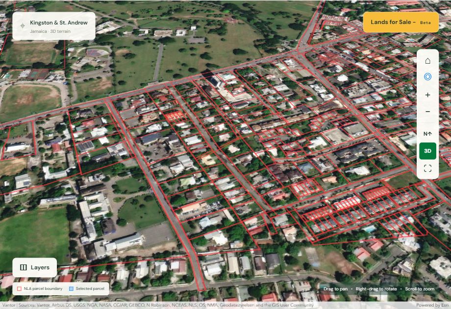
Begin your land journey with a wider view. Find a location, explore parcel boundaries and 3D terrain, then talk to us about the aerial survey information you need next.

  • Search by title, valuation number, or address
  • Explore places and coordinates
  • Switch between overhead and 3D perspectives
Open Parcel Explorer ↗Uses public NLA parcel data. Independent demo; not an NLA service. For exploration, not a legal boundary survey.
JamaicaUAV Parcel Explorer showing aerial imagery, parcel boundaries, and interactive 3D mapping controlsEXPLORE THE INTERACTIVE MAP ↗
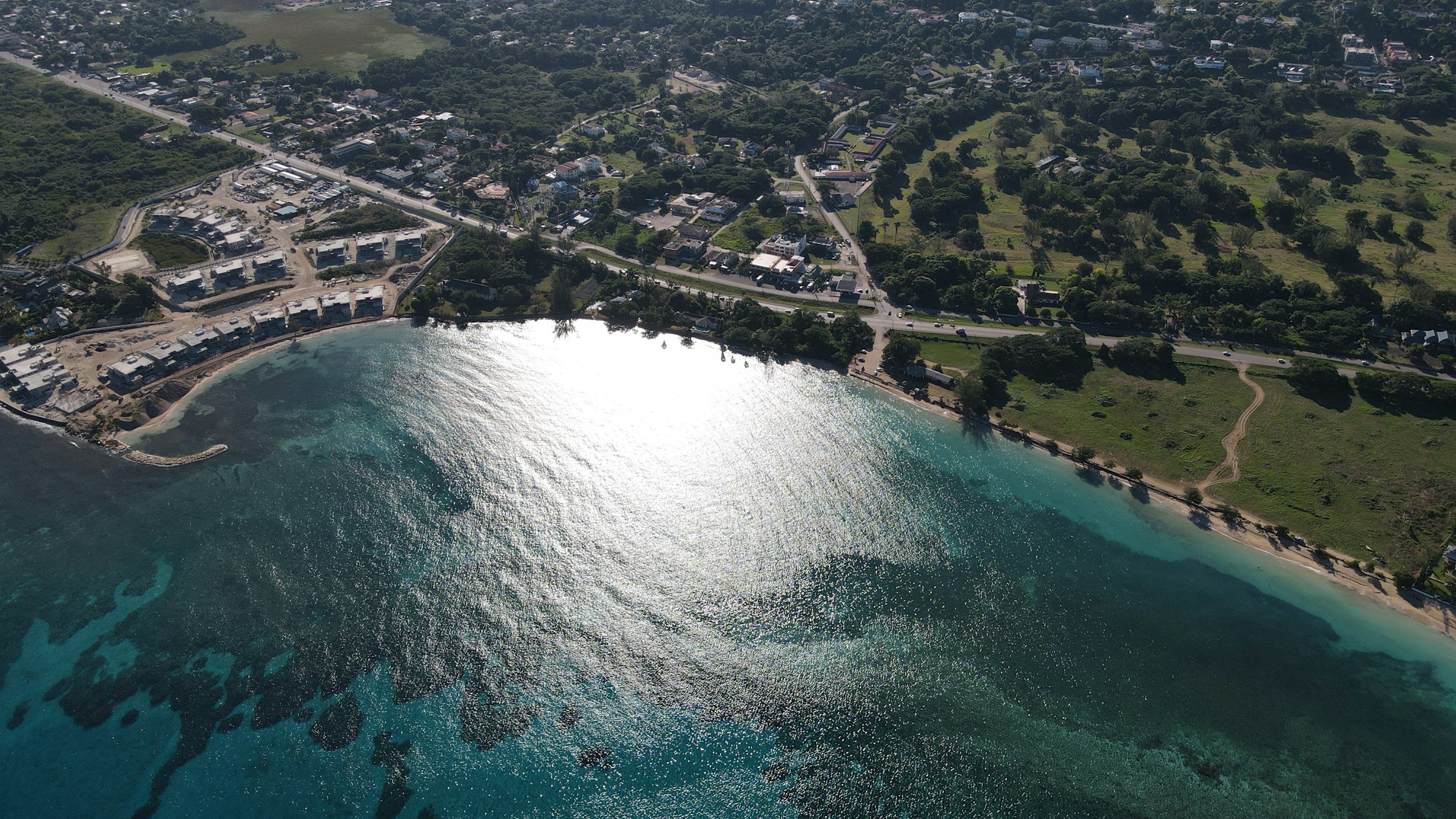
Coastal landscape seen from abovePERSPECTIVE CHANGES EVERYTHING.

02 / ROOTED HERE. LOOKING AHEAD.

A partner who sees
the bigger picture.

Based in Jamaica, JamaicaUAV Ltd. provides drone services throughout the Caribbean. We bring together aerial surveying, mapping, and local knowledge to support the decisions that shape your land.

Our aim is a lasting relationship: learning your site, understanding your goals, and working alongside your surveyors, designers, and project team as those goals take shape.

Discover our approach ↓
✳ Reliable data. Actionable insight.
One partner. Every stage.

03 / CUSTOMIZED DRONE TRAINING

Build skills.
Grow your capability.

Your team.
A higher level.

Customized drone training shaped around your organization’s goals. Tell us about your team, experience, aircraft, and the work you want to do, and let’s discuss a programme that fits.

TRAINING BUILT AROUND YOU

Practical learning.
Relevant to your work.

From building your team’s confidence with drones to developing a more consistent operational workflow, the starting point is what your people need to achieve.

We’ll discuss your objectives and agree the training scope, format, and requirements with you.

04 / BUILT AROUND YOUR PROJECT

A clear path to
a clearer picture.

Start where you are.
Build from there.

01 / DISCOVER

Tell us about the land.

Share your location, project stage, goals, and timeframe. Whether you are considering a purchase or managing an established site, we can start the conversation there.

02 / PLAN

Define the approach.

We discuss site conditions, survey requirements, suitable outputs, and how the information will support your wider project team.

03 / DELIVER

Keep moving forward.

Agree on the first capture and delivery, then plan future mapping and monitoring as your site and priorities evolve.

05 / LET’S MAKE IT HAPPEN

Where are you
on your journey?

A property you’re considering. A site taking shape.
A place you want to protect. Let’s talk.

+1 (876) 672-0754

Monday–Friday · 9:00 am–5:00 pm Jamaica time

ALREADY KNOW THE PROPERTY?

Explore your parcel first

Have a title reference, valuation number, or address? Start with Parcel Explorer, then tell us what you’d like to understand about the site.

OR TELL US ABOUT YOUR PROJECT

Start a conversation

Opens an email draft in your email app. Nothing is sent until you send it.

Your privacy

This website does not store enquiry form entries. With your permission, Google Analytics uses cookies to measure visits and interactions, including links to Parcel Explorer. Analytics is not loaded until you accept. Your choice is stored in this browser and can be changed here. The enquiry form prepares a message in your email application addressed to info@jamaicauav.com. You choose whether to send it.

Information you send by email is used to respond to your enquiry. We do not send enquiry names, email addresses, or messages to Google Analytics. Contact info@jamaicauav.com with questions about your information.

Google’s privacy policy ↗